By: Ben McKay / AAP
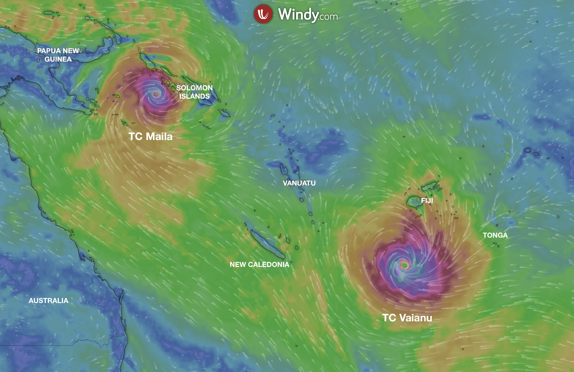
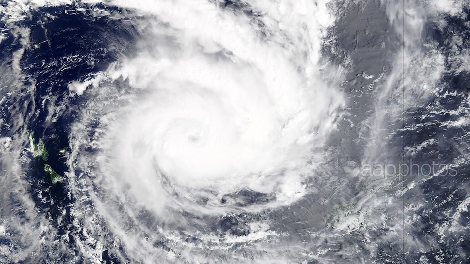
Tropical cyclone Maila has strengthened in the Solomon Sea between Papua New Guinea and Solomon Islands and is now rated as a dangerous category five storm.
Tropical Cyclone Maila has surged to become the season's strongest storm, growing in intensity in the warm waters of the Solomon Sea.
On Wednesday morning, Maila was upgraded to a category five system, with maximum sustained winds of around 215km/h, and stronger gusts.
While the eye is positioned at sea between Solomon Islands and Papua New Guinea, the cyclone's effects are being felt in the two nations, including Bougainville.
National broadcaster SIBC is reporting that three members of one family are missing after a boat capsized in heavy seas.
Images posted to social media show destruction of property in remote parts of the Solomon Islands' Western and Choiseul provinces.
The mighty storm has recorded a lower minimum pressure - 924 hectopascals - than Narelle, which was also rated at category five before it hit Queensland in March.
On some estimates, Maila is the strongest cyclone ever to form in the tropical waters between Papua New Guinea and Solomon Islands.
WeatherWatch head forecaster Philip Duncan said he could not recall such a strong cyclone so close to the equator.
"The location, in a little bubble of sea, is just ideal for what's happening," he told AAP.
"It's stalled, stuck in the same area and getting all that energy off the Solomon Sea, such a warm body of water."
Most modeling expects Maila to head across the tip of the Papuan Peninsula towards far north Queensland, mirroring the track Narelle traversed.
It is unclear when the cyclone will arrive, or at what intensity, with some models suggesting a sharp downgrade.
"There's a big question mark for Queensland as to what will happen," Mr Duncan said.
TC Vaianu
In the South Pacific, another cyclone, tropical cyclone Vaianu has moved south of Fiji and remains a category three system with sustained winds up to 130km/h near its eye.
Most tracking models have the system crashing into New Zealand's North Island on the weekend, with the MetService warning of "damaging, potentially life-threatening winds, heavy rain, and hazardous coastal conditions".
A strong wind watch has been issued for the entire North Island on Sunday, with forecasters tipping it will be upgraded in parts to an orange or red warning, the highest level of alert.
Mr Duncan said the Coromandel Peninsula, Tairawhiti region and Northland were likely to see the highest rainfalls.