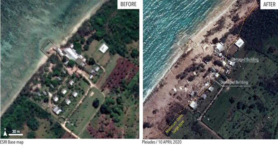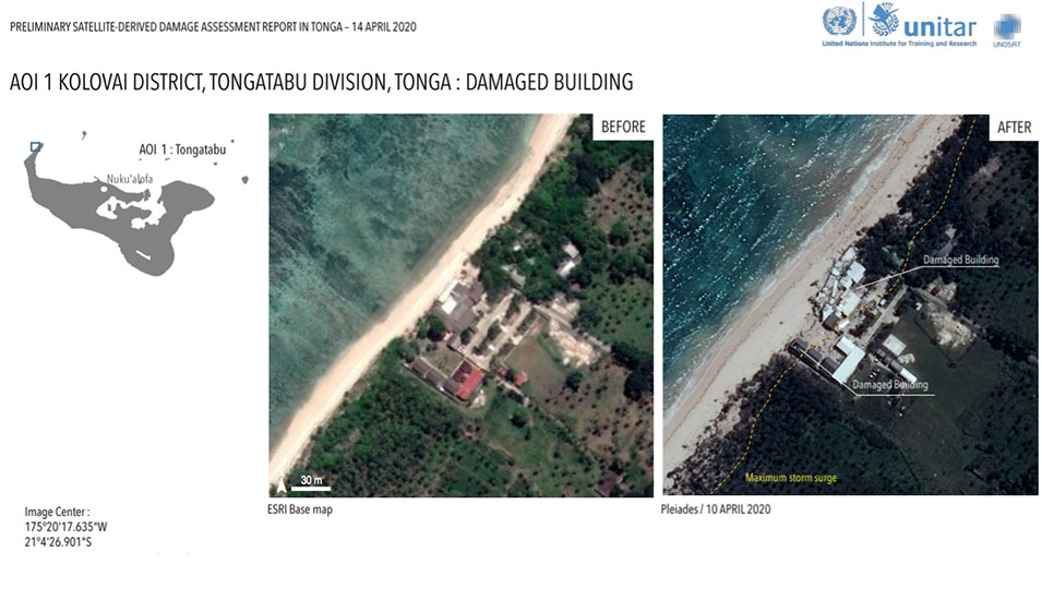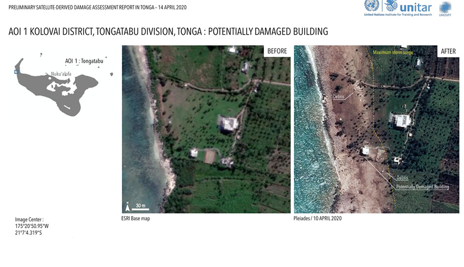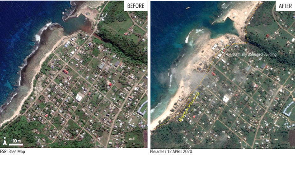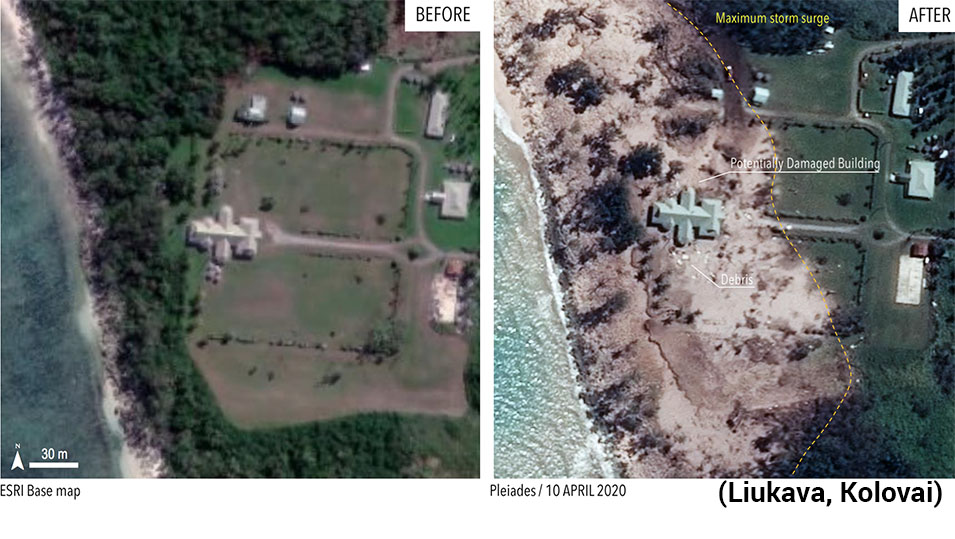
Extensive damage on Tongatapu and 'Eua coastlines caused by Severe Tropical Cyclone Harold is shown in dramatic before and after satellite images released by the UNITAR / UNOSAT in a preliminary report today.
Satellite images show locations of severely damaged structures along north western coast of Kolovai district in Tongatapu, including the Royal Residence Liukava on the coast at Kolovai. The images also show how far the storm surge came through the heavily damaged beach resorts
Storm surge damage was observed in 'Eua division and Ha'apai division causing damage to houses and buildings.
However, no visible structural damage could be identified in the Vava'u division as of 12 April, from the satellite imaging.
The United Nations Institute for Training and Research (UNITAR) based in Geneva, Switzerland published a "Preliminary satellite-derived damage assessment in Tonga" with observations of the impact and severity of TC Harold storm surge on 9 April 2020.
Link: UNITAR/UNSAT PDF 2.7MB Preliminary satellite-derived damage assessment in Tonga
