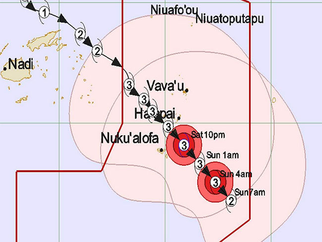
In a surprising trick of nature, the eye of Severe Tropical Cyclone Tino (Cat. 3) passed over Tonga on Saturday, 18 January, while barely grazing the capital Nuku'alofa, which was on track for a direct hit. The eye passed between the Ha'apai Group and Tongatapu Group.
Tonga cyclone observers were amazed to see the centre of TC Tino pass just to the North of Tongatapu but without its predicted high winds and heavy rain, while at the same time the northern Tongan groups of Vava'u and Ha'apai were being hammered by destructive storm force winds and torrential downpours, with gusts estimated at 90 knots (180km/hr).
Paula Mau, director of Tonga's National Emergency Management Office (NEMO), said on Saturday evening that there were no casualties or injuries reported from throughout Tonga from the large cyclone.
“Our Met Office says the face of Tino was to the North where all the wind and rain was, but on the South side it turned a large blind eye on Tongatapu, even though it was so close. It is surprising to see the effects of nature.”
Nuku'alofa and Tongatapu, home to most of the Tongan population, along with nearby 'Eua, are still recovering from extensive damage caused by Cyclone Gita only two years ago. Today's near miss was a relief for NEMO.
Storm surge
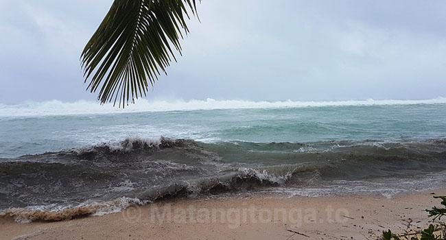
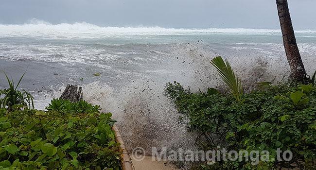
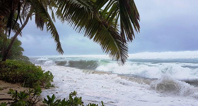
However, Paula said the coastal areas of Tonga have been hit hard by storm surges from Cyclone Tino, which passed over central Tonga at high tide. Sea levels were exceptional.
Nomuka, located between Ha'apai and Tongatapu, was closest to the centre of the storm.
“We believe there is severe storm surge damage at Nomuka and our team are there doing some surveys now,” he said. Tonga's National Emergency Management Committee met this evening and will meet again at 8:00am on Sunday, January 19. “We need an immediate response.”
“We will start tomorrow in Tongatapu to conduct a survey exercise covering the coastal areas, and agriculture and the villages. This will also be done by our teams in Ha'apai, Vava'u and the outer islands.”
Coastal damage
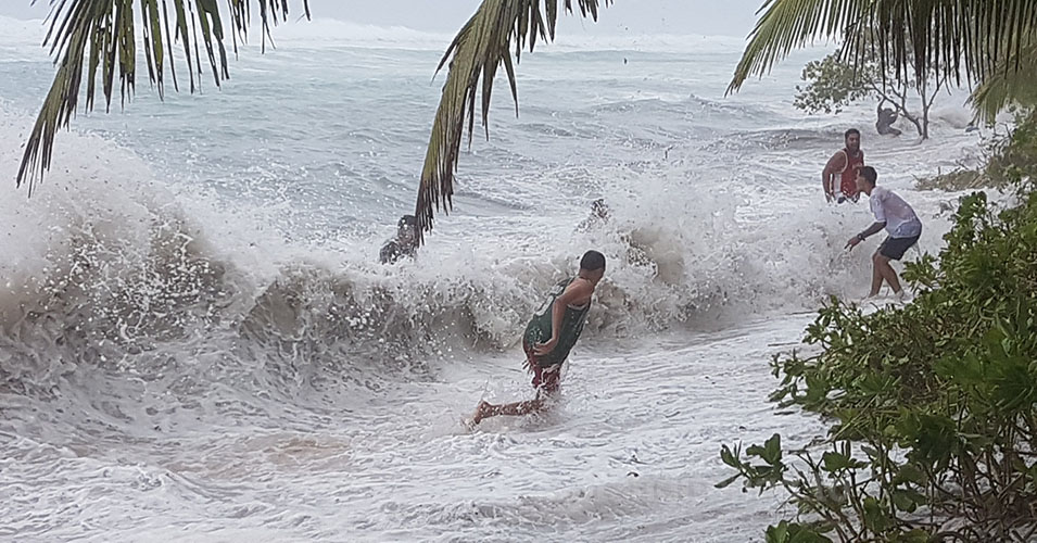
Tongatapu's southern coast, famous for its blowholes, was getting a pounding from heavy seas as TC Tino moved away.
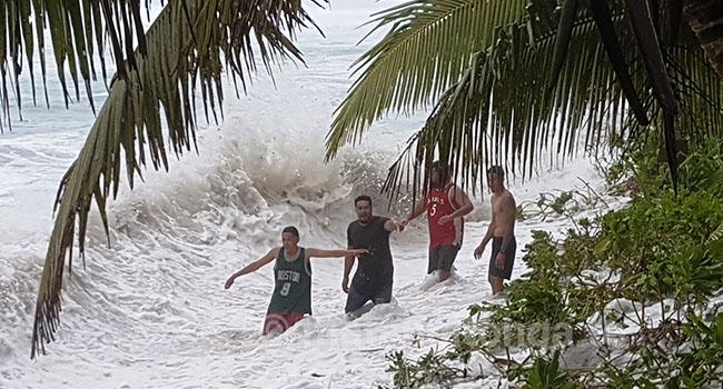
“This was perhaps the second biggest swell on this North West side of Tongatapu in the past 25 years,” said wave watcher Shane Egan at Blue Banana Beach House, on Saturday. He said the waves came up onto the edges of the property sweeping away logs and fenceposts, however they considered themselves lucky.
“Very lucky out here on Kanokupolu Beach, with the eye of TC Tino passing to the north of us. If the wind had come around onshore, from the North West, it would have been a major disaster as far as wave destruction and coastal erosion is concerned.”
“Some of the braver youth from Kanokupolu made the most of the freak wave conditions.
“There was so much debris in the water to avoid - all our step logs, coconuts, coconut trees, branches, fence posts with nails and large coral boulders. Everyone appeared to survive the day pretty much unscathed with no serious wounds,” he said.
Flights
International flights to Tonga were cancelled or delayed on Friday and Saturday. Air New Zealand flights from Auckland and Air Fiji flights from Nadi were affected. All local domestic flights were cancelled.
Airlines are rescheduling passengers for Monday.
NASA research
TC Tino had very cold cloud top temperatures that had the capability to produce heavy rainfall, according to a report by NASA's Goddard Space Flight Center, which analyses data for hurricane research.
“Water vapour content and temperature information collected by NASA's Aqua satellite, passing over Fiji on the morning of January 17, showed the highest concentrations of water vapour and coldest cloud top temperatures were around the centre of circulation. Coldest cloud top termperatures were as cold or colder than minus 70 degrees Fahrenheit (minus 56.6 degrees Celsius) in those storms.”
“Water vapor analysis of tropical cyclones tells forecasters how much potential a storm has to develop. Water vapor releases latent heat as it condenses into liquid. That liquid becomes clouds and thunderstorms that make up a tropical cyclone. Temperature is important when trying to understand how strong storms can be. The higher the cloud tops, the colder the cloud tops and the stronger the storms.
“Tropical cyclones/hurricanes are the most powerful weather events on Earth.”
- Mary Lyn Fonua.