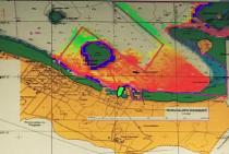
Key areas of Tonga’s seabed approaching the harbor of Nuku’alofa, is being mapped by state-of-the-art multibeam sonar equipment chartered by the UK Hydrographic Office (UKHO) to update nautical charts and publications. According to UKHO, accurate and up-to-date charts for safer navigation may boost Tonga's blue economy.
You are here
Results for UK Hydrographic Office (UKHO)
Monday 5 March 2018
 Premium content
Nuku'alofa, Tonga


