From our Archives

Photos by Lothar Slabon and Mohammed Razak.
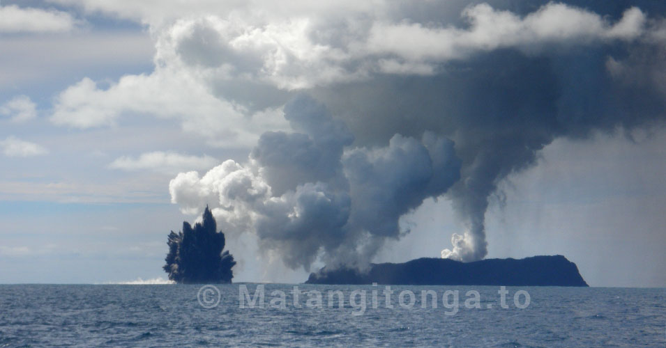
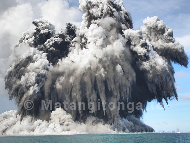
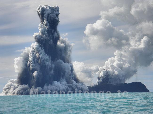
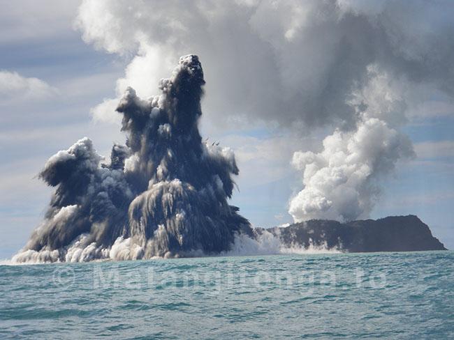
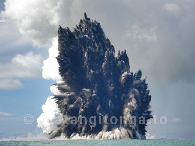
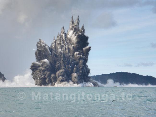
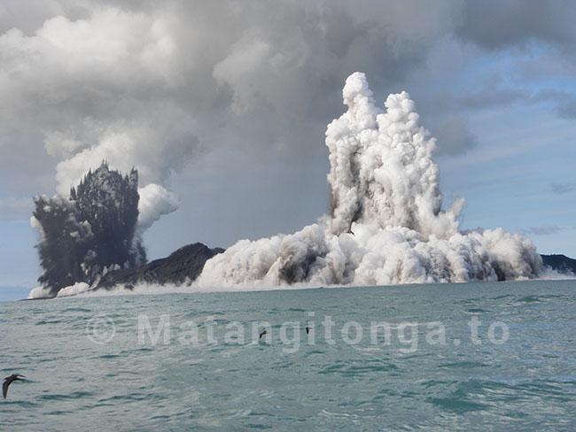
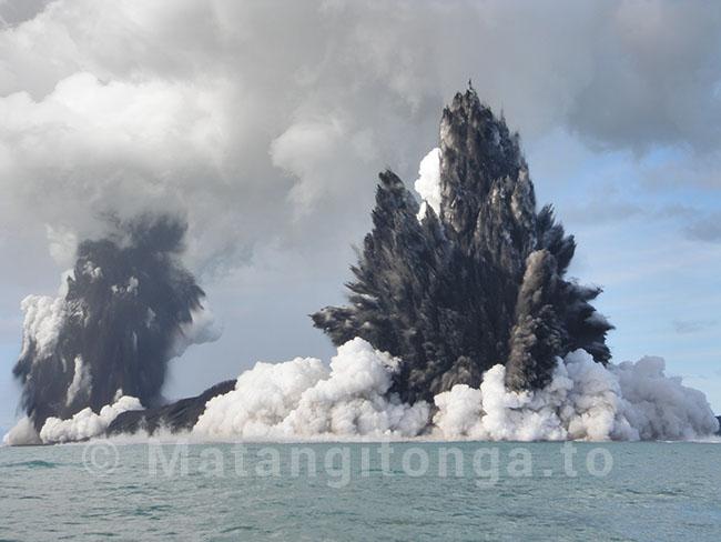
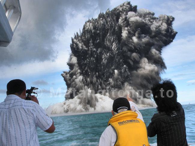
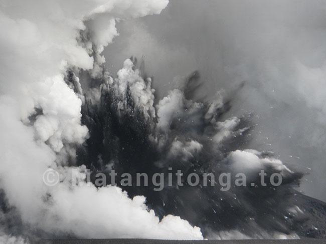
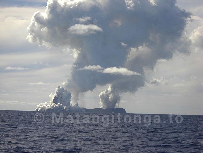
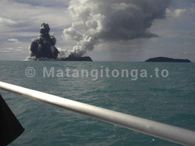
There was a moment of panic as a boatload of observers had a close encounter with an explosive eruption on Hunga Ha'apai yesterday, 18 March 2009, when they moved in close to take spectacular photographs of an eruption that is continuing today, 19 March 2009, only 34 nautical miles off the coast of the capital Nuku'alofa.
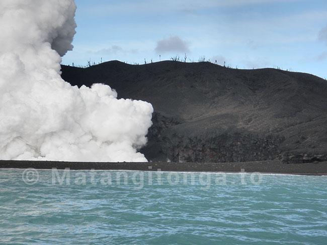
Lothar Slabon a resident of Nuku'alofa said the island has two active vents - one on land and one from the sea. The loud explosions were happening at intervals of every three minutes or so, throwing huge clouds of volcanic material into the air, he said. A mushrooming column of white smoke can be seen from Nuku'alofa.
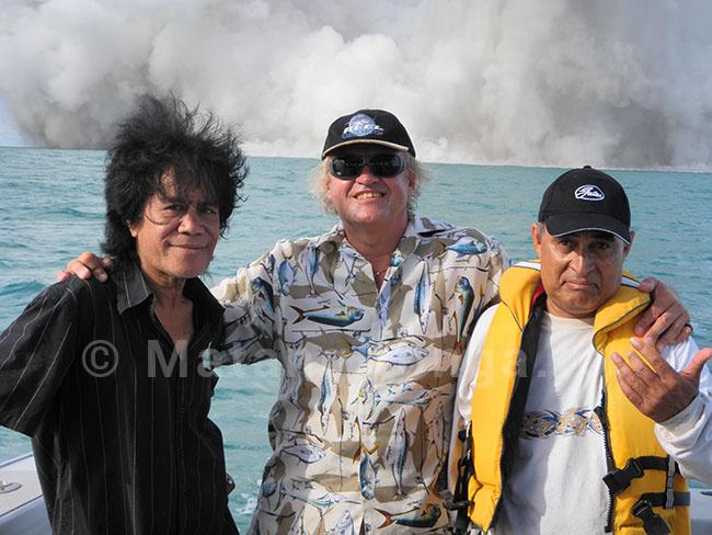
He went out to the area on the game-fishing charter boat the "Southern Extreme" skippered by Mohammed Razak after he saw the eruption from his home in Sopu yesterday. At about 3:00 pm they were holding a position south of the island, which they thought was a safe distance away and downwind, when a loud explosion sent a huge cloud of steam and ash billowing toward them.
"I shouted to turn the boat around, because I thought we could gun it away ahead of the cloud of ash," he said.
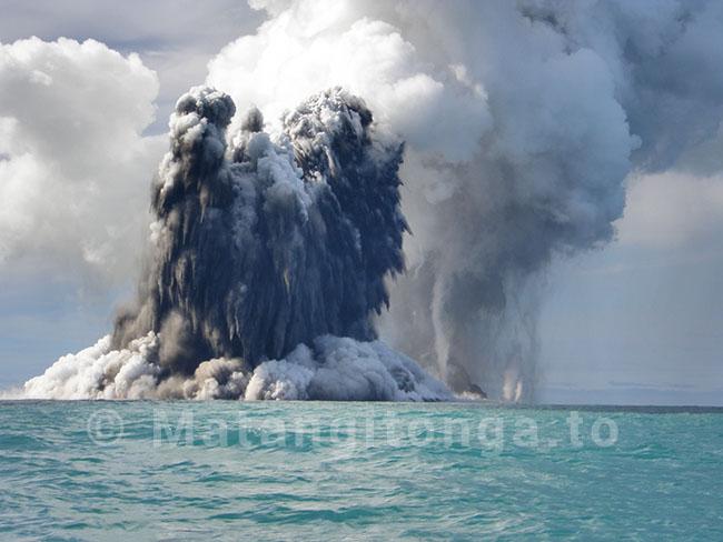
Fortunately, the billowing cloud stopped before it reached the boat but Lothar said that soon after they left and were about a mile and a half out from the island another explosion engulfed the area where they had been sitting.
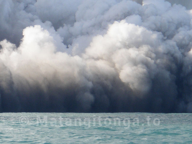
"It was a massive explosion the biggest of all we had seen, and it would have definitely covered the boat if we were still sitting in that spot," he said.
Rains
The eruption is sending intermittent blasts of volcanic material and smoke thousands of metres into the sky.
"After each blast it rains heavily because so much water is being thrown up as well as the big rocks, so the scene is changing all the time," he said. The rocks are being thrown hundreds of feet into the air and are landing close to the island.
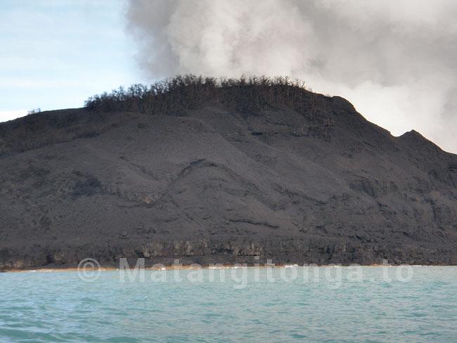
"The island has a new extension of about 200 metres and about five metres high," he said.
"But it is completely burnt and all the wildlife - the plants and the birds on the island- has been wiped out, the birds couldn't get away," he said.
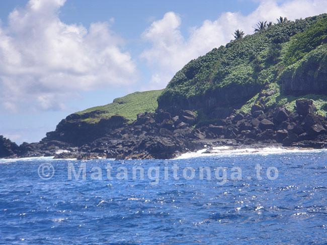
Lothar was fishing in the area on February 20 and took pictures of the island in its pristine condition as it was before the eruption.
The eruption is continuing today and can be clearly seen to the north west from the Nuku'alofa waterfront, and also from Kanokupolu Beach and Ha'atafu Beach..
The government geologist Kelepi Mafi has warned fishermen not to go near the area, which is still extremely dangerous.
Active vents
The small islands of Hunga Tonga and Hunga Ha'apai cap a large seamount located about 30 km SSE of Falcon Island. According to the 'Volcanoes of the World' website, the two linear andesitic islands were about 2 km long and represent the western and northern remnants of a the rim of a largely submarine caldera lying east and south of the islands.
Hunga Tonga and Hunga Ha'apai reach an elevation of only 149 m and 128 m above sea level, respectively, and display inward-facing sea cliffs with lava and tephra layers dipping gently away from the submarine caldera.
A rocky shoal 3.2 km SE of Hunga Ha'apai and 3 km south of Hunga Tonga marks the most prominent historically active vent. Submarine eruptions were reported here in 1912 and 1937 and from a fissure 1 km SSE of Hunga Ha'apai in 1988.


