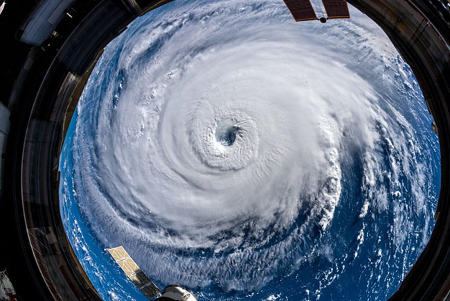
A remarkable satellite image shows Hurricane Florence in the Atlantic is one of just nine potentially dangerous storms currently circling around the world.
The image circles some of the points where the most extreme weather is set to batter the world this week, giving a word of warning about the dangers they pose, the Daily Mail reported.
Jamaica Weather posted the photograph online, saying: "This going to be a crazy end to the week! Take a look across the Tropics."
Each storm is clearly highlighted on the map and identified with a name, showing that Hurricane Florence is not the only storm looming.
Hurricane Olivia is heading towards Hawaii as Tropical Storm Paul is approaching the west coast of Mexico.
Storm 91W, Typhoon Mangkhut and Storm 27W appear to be heading towards South East Asia as they line up in the Western Pacific.
Hurricane experts say it is unusual for there to be active storms in the Atlantic Ocean and Pacific Ocean at the same time.
"The thing that's interesting now is the Pacific is still active, but the Atlantic is very active, which isn't normal," Phil Klotzbach, an atmospheric science researcher at Colorado State University, told NBC News.
"I'm surprised to see the Pacific and Atlantic active at the same time."
Since the hurricane season began this summer, there have been nine named storms in the Atlantic, which is above average, Klotzbach said. There have been 15 identified storms in the Pacific since the hurricane season began.
Hurricane Florence.

Today NASA's website was posting dramatic images from space of Hurricane Florence over the Atlantic. One million residents have been told to evacuate their homes as Hurricane Florence approaches North and South Carolina, USA.


